
Why Scanner Accuracy Doesn't Equal Site Accuracy
High-precision equipment is only part of what makes a 3D scan reliable.
Scanner specifications describe instrument performance under defined conditions. Reliable construction data also depends on field conditions, scan registration, site control, and verification against the intended use.
A modern 3D laser scanner can capture millions of points in minutes. Some instruments offer millimeter-level measurement accuracy under specified conditions.
Looking at those specifications, it's tempting to assume the resulting 3D model will be just as accurate.
But anyone who has worked with laser scanning on a large construction site knows it's not quite that simple.
The same structure can produce different measurements depending on how it's scanned. And even when individual scans look accurate, the final combined dataset may tell a different story.
So where do those differences come from?
1. The Site Doesn't Follow the Specification Sheet
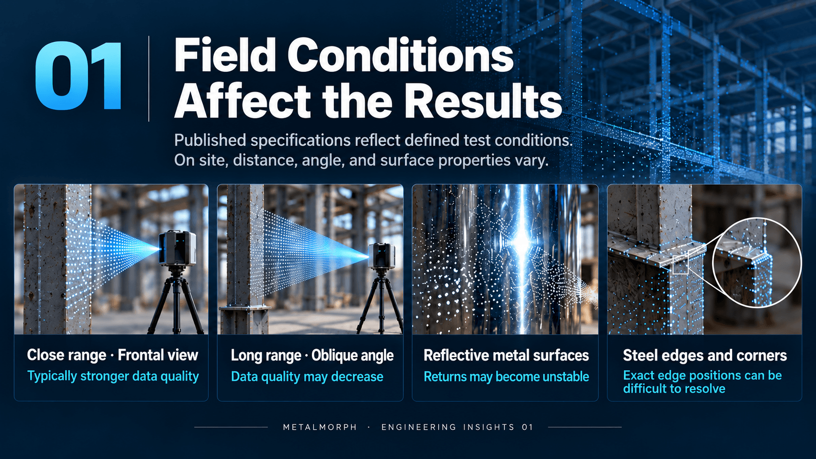
Equipment specifications are measured under defined conditions. Construction sites rarely offer those conditions.
Take a steel column, for example.
Scanning it from a short distance, directly facing the surface, is very different from scanning it at a steep angle from across the building.
The distance changes. The angle changes. And so does the quality of the data.
Surface conditions introduce another challenge. Reflective metal, dark finishes, and sharp edges can affect how the laser signal is captured.
A steel edge is particularly interesting. What looks like a perfectly defined corner on the structure may not appear as a clean, precise line in the point cloud.
Then there are the practical problems: pipes blocking the view, equipment in the way, and areas where the scanner simply cannot be positioned where you'd like.
None of these conditions automatically makes a scan unusable. But they do mean that not every measured point is equally reliable.
2. One Accurate Scan Doesn't Mean an Accurate Building
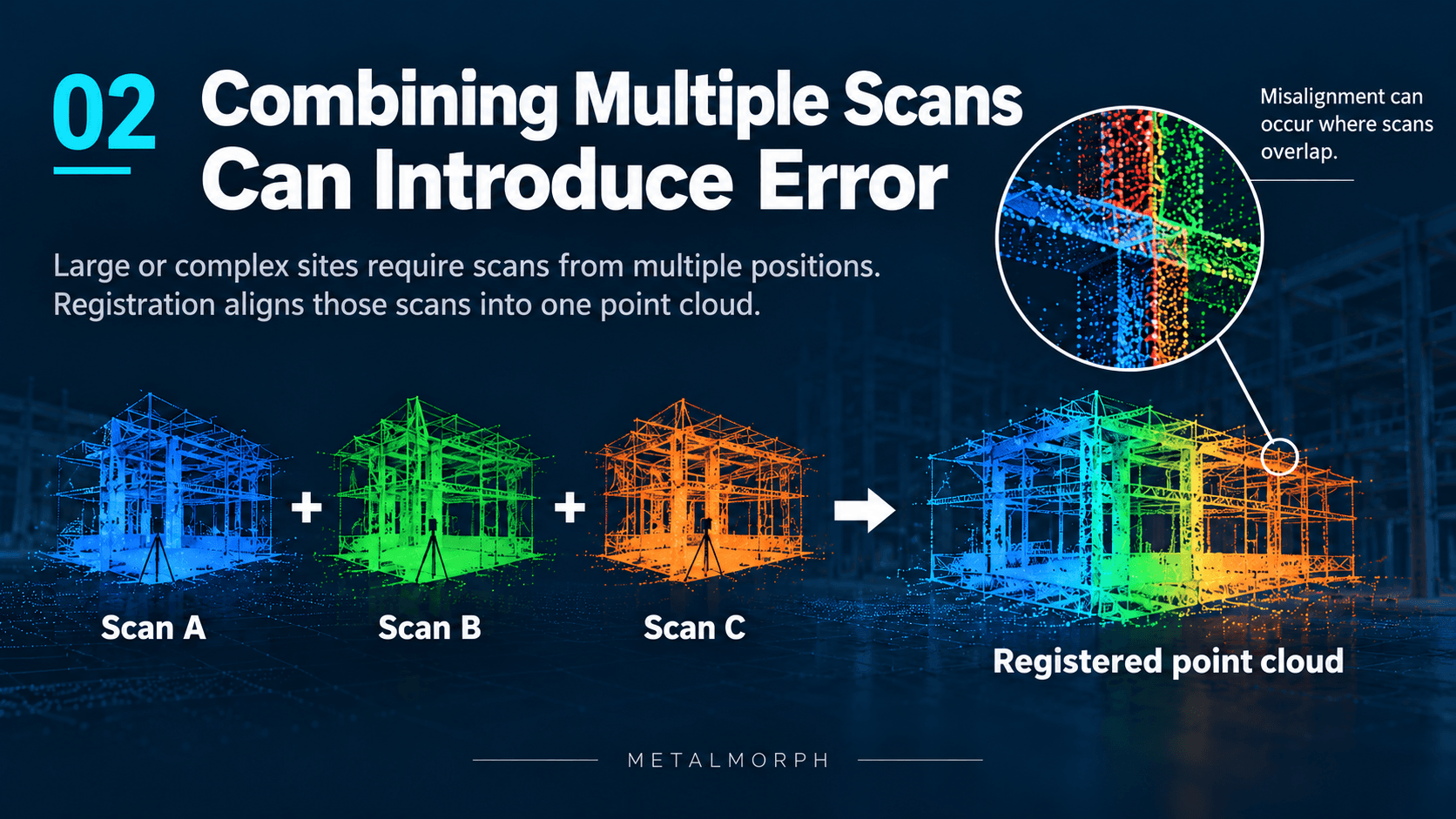
Scanning a large industrial facility usually means moving the scanner from one position to another, sometimes dozens of times.
Each scan captures a different part of the site. Those scans then need to be combined into a single dataset.
This process is called registration.
Imagine capturing a steel structure from Position A, then moving to Position B. The software needs to align the two scans using overlapping geometry, reference targets, or other positioning information.
If that alignment is slightly off, the scans may still look reasonable on screen.
Now repeat that process throughout an entire building.
Small registration errors can affect the overall result, particularly when scans are connected sequentially without sufficient independent checks.
This doesn't mean errors always accumulate in the same direction. Proper survey control and registration methods can significantly reduce the problem.
But there's an important distinction:
A scanner can measure individual surfaces precisely without producing an equally accurate model of the entire facility.
3. A Point Cloud Can Look Right and Still Be in the Wrong Place
This is one of the less obvious challenges of 3D scanning.
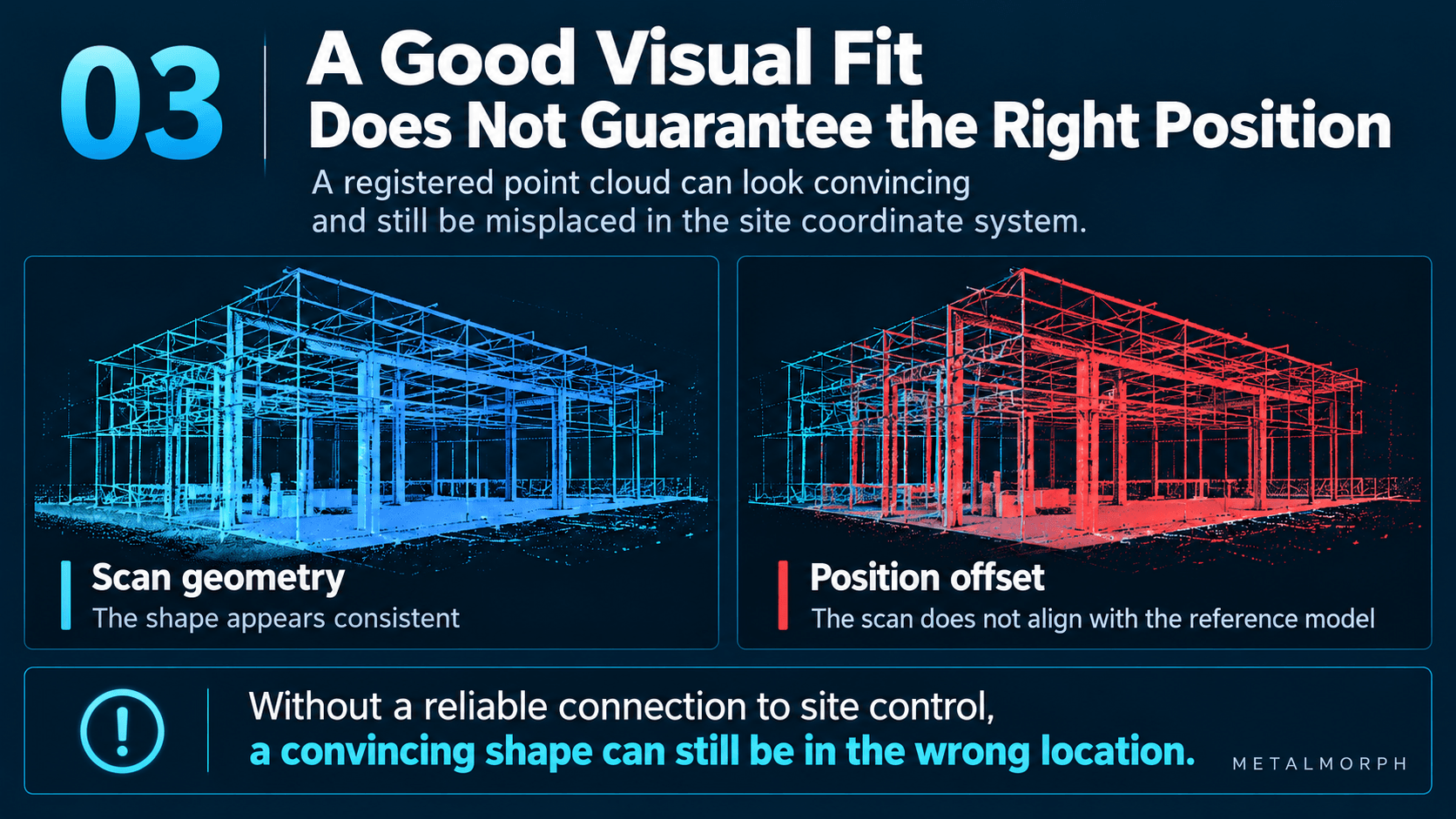
Imagine a point cloud that captures every column, beam, and pipe in a building with excellent detail.
The geometry looks right. The distances between components look right.
But what if the entire dataset is shifted slightly from its actual position?
Nothing about the building's appearance would necessarily reveal the problem.
The difference becomes apparent when the point cloud is compared with project survey coordinates, an existing design model, or independently measured reference points.
That's why registration quality and positional accuracy should not be treated as the same thing.
A low registration error is encouraging, but it doesn't necessarily confirm that the dataset is correctly positioned within the project's coordinate system.
For general documentation, that distinction may not always be critical.
For prefabrication or installation work, it can make a substantial difference.
This distinction becomes especially important when working with existing structures. On our HU Multi-Cultural Center project, 3D scanning and as-built verification helped identify differences between the installed steel structure and the digital fabrication model.
4. The Operator Still Matters
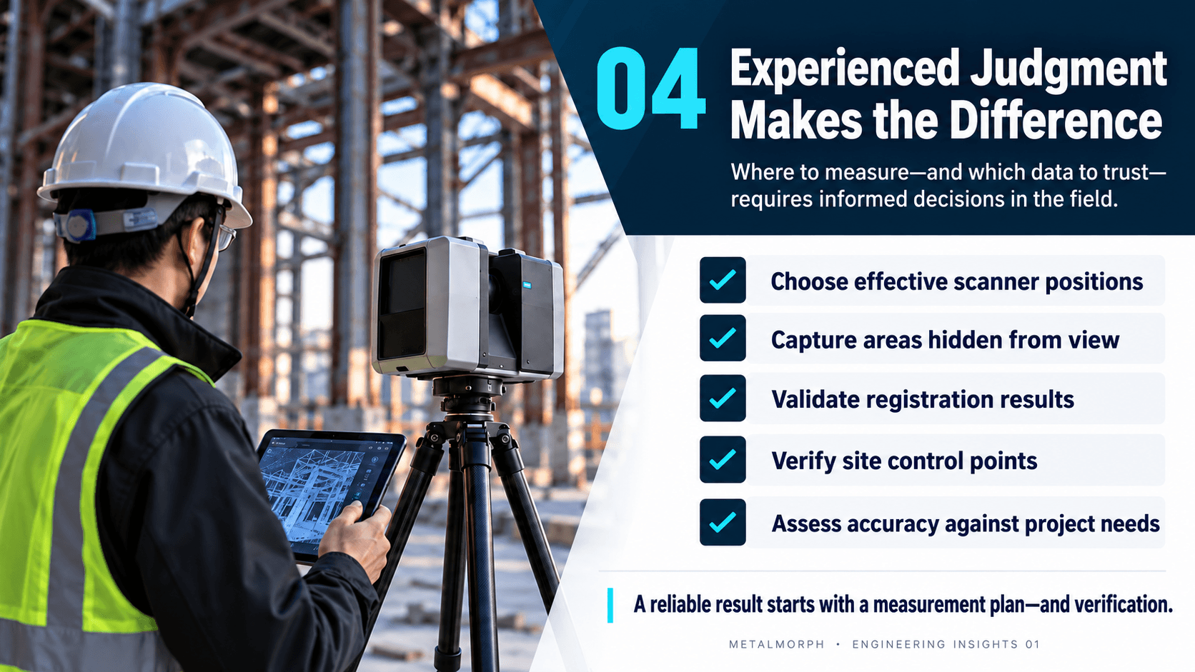
Laser scanning has become increasingly automated, but good measurement still requires judgment.
Where should the scanner be positioned? Which surfaces are suitable for measurement? What areas need a second look? And how can the final data be checked?
The answers depend on the site and, just as importantly, what the data will be used for.
A scan intended to document general building conditions is different from one intended to verify the connection points for prefabricated components.
Both may use the same equipment. They don't necessarily require the same approach.
An experienced operator understands that collecting more points isn't always the answer.
Sometimes the most important measurement is a small connection detail hidden behind a pipe, not the millions of points already captured across the rest of the building.
When Accuracy Becomes a Construction Problem
These differences matter most when digital measurements begin to influence physical work.
At MetalMorph, our work involves complex metal geometry, where design, fabrication, and installation have to come together.
A curved metal panel may be fabricated within its specified tolerances and still present challenges on site if the existing structure differs from the information used during design.
That is why reliable site data matters to us.
It's not simply about having a detailed point cloud. It's about understanding the accuracy of that data and whether it is suitable for the engineering decisions that follow.
A scanner can tell us where millions of points are. The engineering challenge is knowing which of those measurements we can trust when it's time to build.
Complex Metal Geometry. Delivered with Certainty.
MetalMorph | Engineering · Digital Fabrication · Dimensional Verification

